Gangotri and Gomukh

Group photo at National Institute of Mountaneering, Uttarkashi

Uttarkashi, from the hotel balcony

Harsil, on the way to Gangotri from Uttarkashi

Bhagirathi rushing through Gangotri. This picture was
taken from the steps of the Ganga temple.

Sunrise on the Gangotri peaks.

Mahadeber jata -- the dreadlocks of Shiva.
Bhagirathi flows and falls thorugh crevices in the limestone.

Another view of the jata.

Another group photo taken in front of the hotel in Gangotri.

Another view of Gangotri taken from above, as we started
from there to go to Bhujbasa on the way to Gomukh. Bhujbasa
is a 14km trek from Gangotri, and Gomukh is another 4km.
Altitude increases by about 1km between Gangotri and Gomukh,

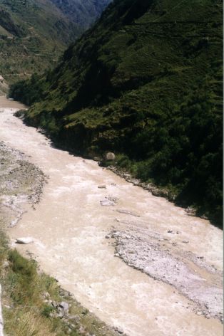
Bhagirathi, seen from the path to Gomukh.

Another view of Bhagirathi on way to Gomukh.

Mountains watching over Bhujbasa.

Shivling peak, which becomes
visible on the path
to Gomukh. The Gangotri glacier begins at the foot
of this mountain and ends in Gomukh.

My companions on the final trek to Gomukh, in front
of the Gangotri glacier at Gomukh. From left to right
Amitabha Ghosh, Narayan Chakrabarti and our porter
Rajinder Singh Gosain.

Bhagirathi as it comes out of the Gangotri glacier
at
Gomukh. Ice is visible on the edge of the river at
the bottom of the picture.

Full view of Gomukh, the
mouth of Gangotri glacier.
The glacier is 40 metres high, 200+m wide at Gomukh
and goes on for at least 10 km, up to the foot of Shivling.

Gomukh, the final destination of the trek, close
up.
This is also the background image for this page.


